The Auckland suburb where we live has had its fair share of bridges.
Before a bridge, the only way to cross the Tamaki River was “by a leaky and somewhat unreliable punt which frequently had a broken chain or was holed. Delays of up to an hour could occur when stock were crossing. The average number of daily passengers was 180 people, 53 horses, 23 carts, 100 livestock.”
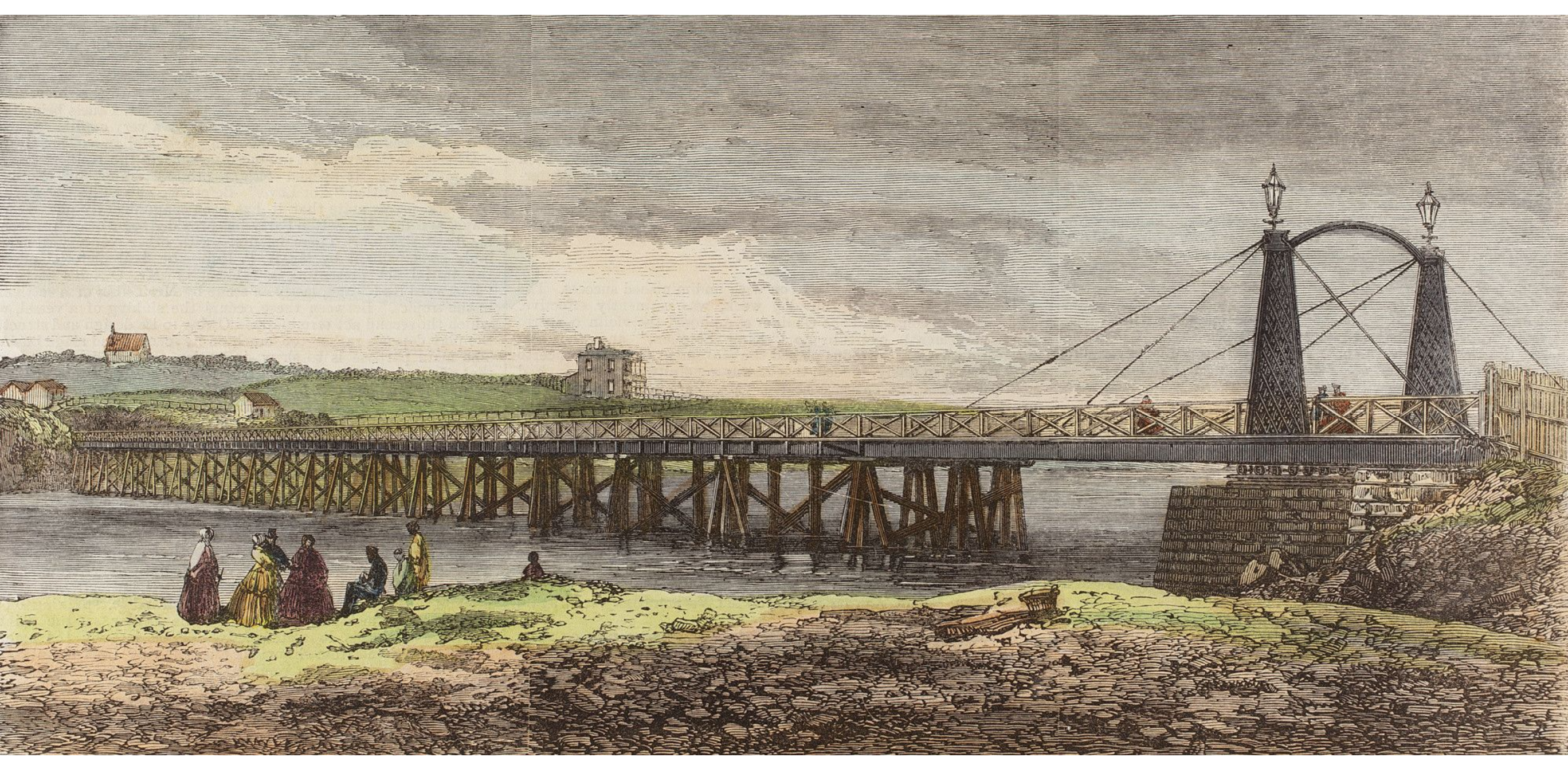
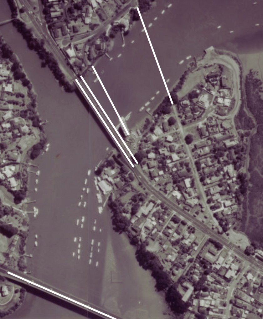
First Panmure to Pakuranga bridge, 1865-1918
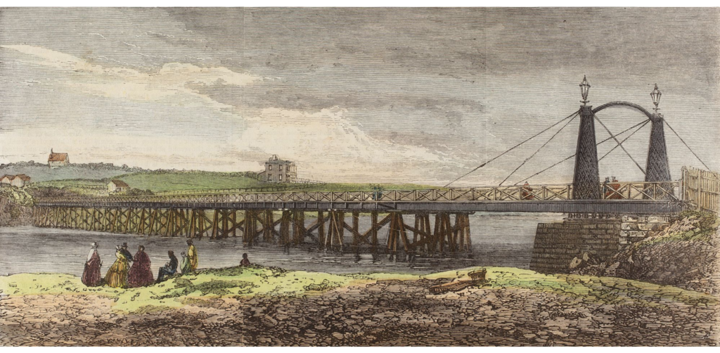
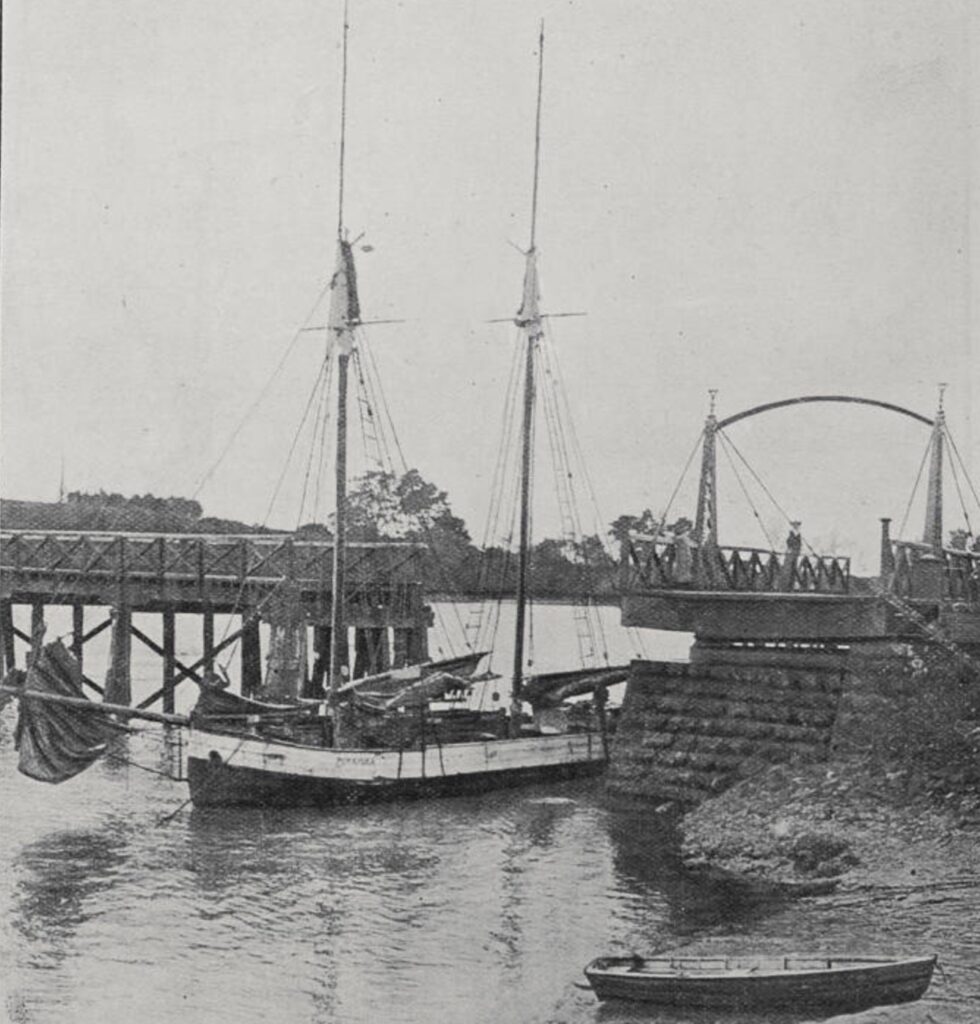
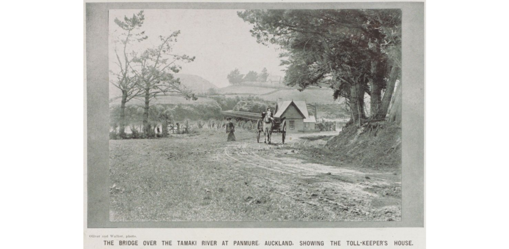
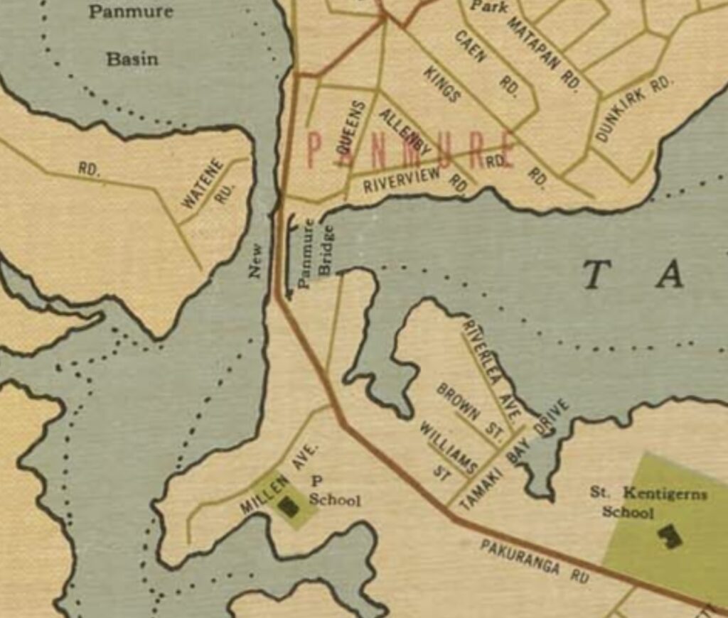
The first Panmure bridge was officially called the “Tamaki Bridge”, and was officially opened on 20 October 1865 by Robert Graham, Superintendent of the Auckland Provincial Council. The bridge was 195 metres long and 6 metres wide with kauri decking. The eastern end connected to the western tip of what is now the Pakuranga Road, while the western end connected with the remains of Mokoia Pā (a fortified settlement that was once home to the Maori Ngāti Paoa people) and what is known today as Bridge Street, Panmure.
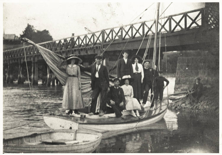
A unique feature of this first bridge was the inclusion of a 40-foot (23.8 m) span on the eastern end was constructed with iron and designed to rotate 90 degrees to allow boats travelling along the Tamaki River to pass through (hence its nickname of the “Panmure Swing Bridge“). The swing span bridge was managed by a toll keeper who lived in a cottage on the Pakuranga side. On the Panmure side, a steep hill (the remains of Mokoia Pā) awaited and travellers sometimes needed to get off their horses and push!
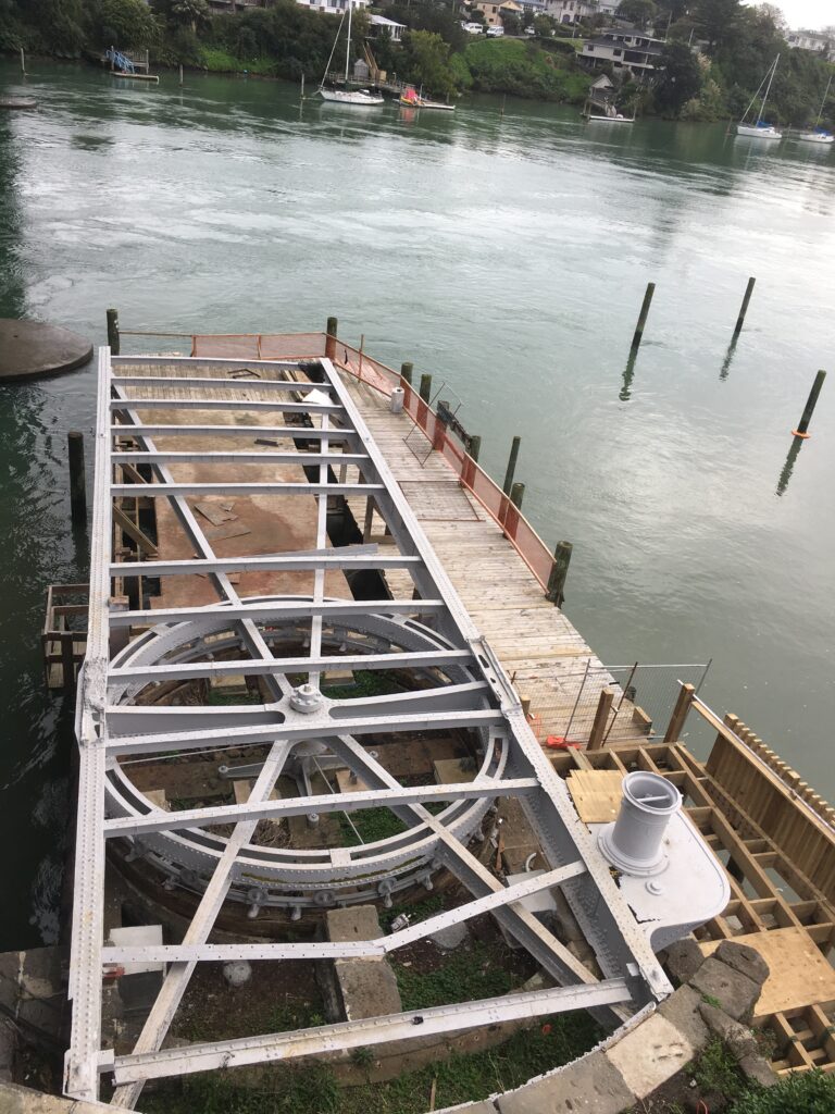
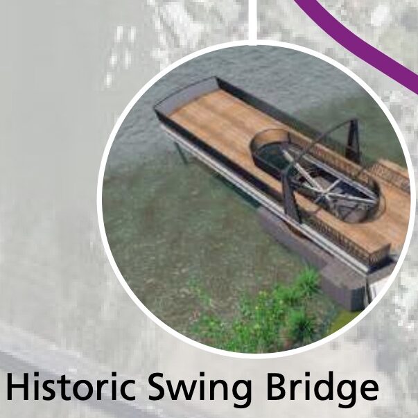
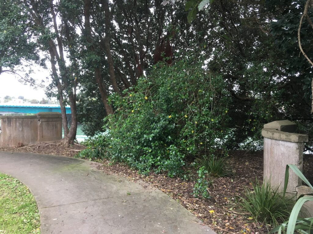
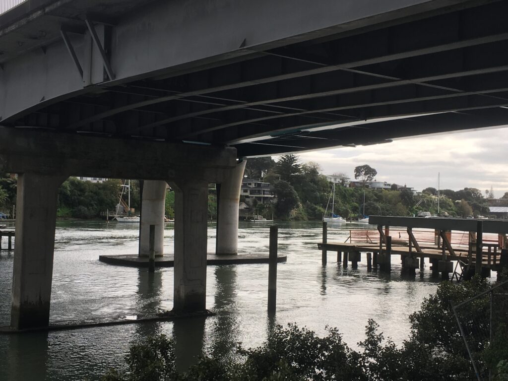
With the introduction of motorised vehicles at the turn of the 20th century, plans were drawn up for a bigger, taller Tamaki River crossing. By 1918, the first Panmure bridge had been demolished. While the original Tamaki crossing is no longer around, for a time a marina shop was built over the foundation of the swing bridge mechanism (eventually demolished to make way for the Eastern busway bridge). Today, the remains of the historic swivel bridge mechanism are still visible, having been preserved by Auckland Council. As of 2023, additional conservation works and a viewing platform for pedestrians and cyclists are being built over the stone abutment and iron swing span mechanism as part of the AMETI Stage 2a Urban Design and Landscape Plan.
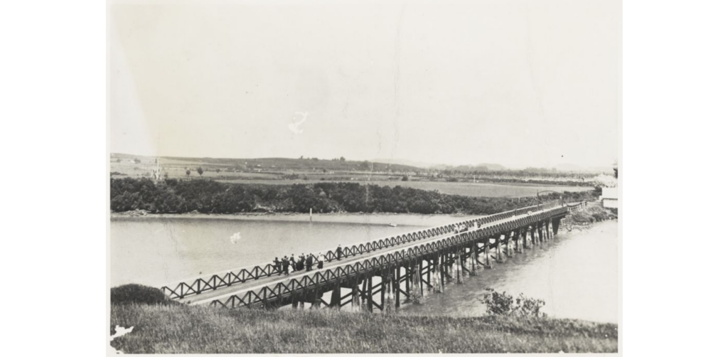
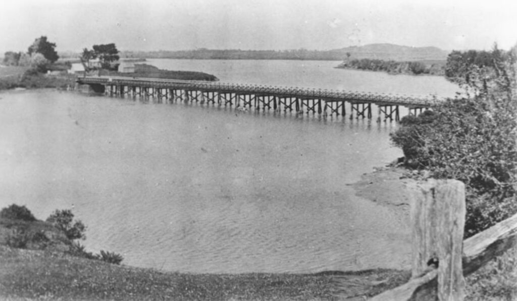
Second Tamaki / Panmure Bridge, 1916-63
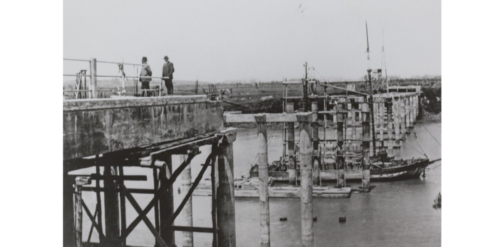
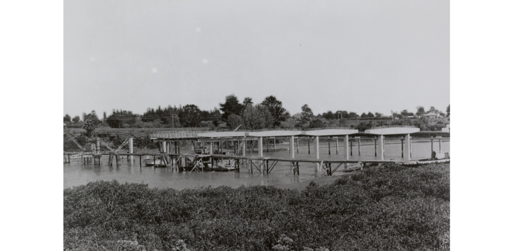
The second Panmure bridge under construction in 1915. Source: Auckland Libraries Heritage Collections Footprints 01396
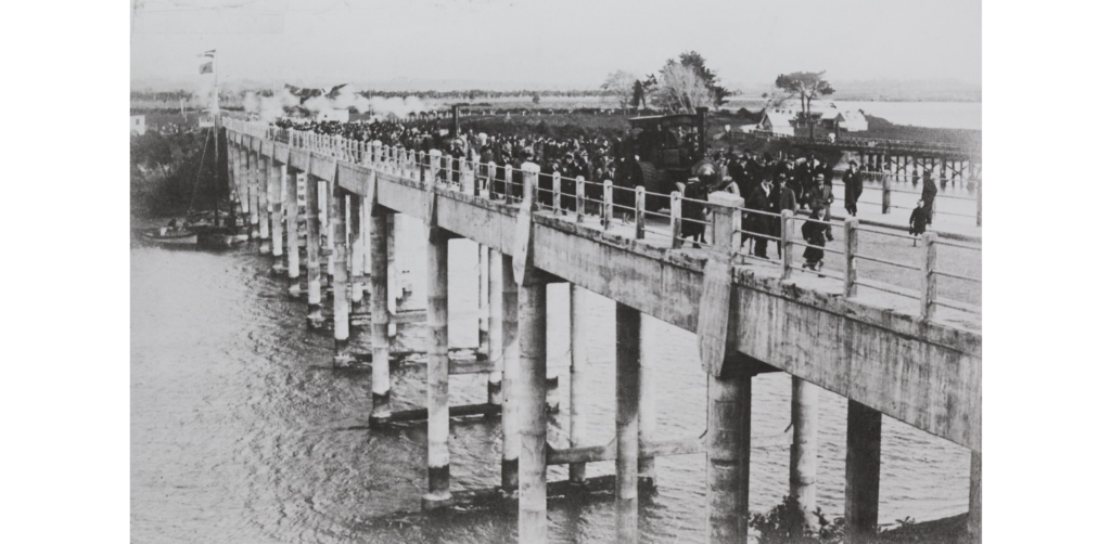
Official opening of the new ferro-cement bridge across the Tāmaki River between Panmure and Pakuranga, 14 August 1916. Prime Minister W.F. Massey leads the way with a traction engine. Source: Auckland Libraries Heritage Collections Footprints 01397
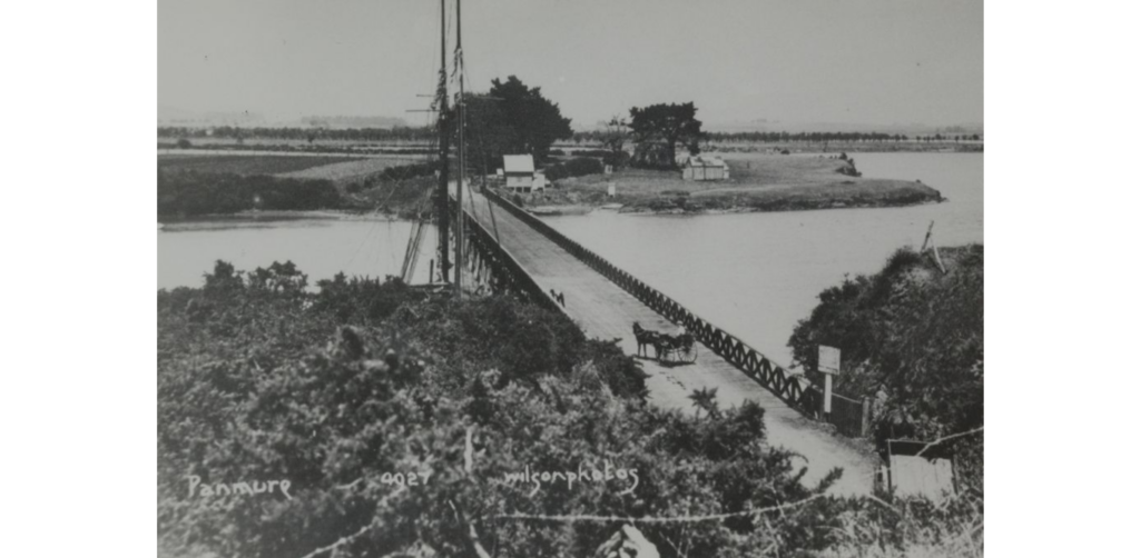
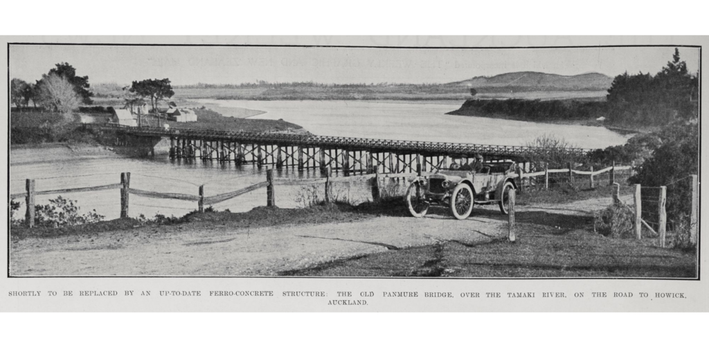
By the 1900s, the flat river plains of Pakuranga had become known as “the granary of Auckland”, with farmers growing oats, hay and wheat. The second Tamaki bridge was completed approximately 100 yards downriver on 14 August 1916. Nicknamed the “Iron Bridge”, it was in reality a ferro-concrete structure using sea water in the concrete, sand from Buckland’s Beach and war-time (poor) quality steel. The bridge connected at Queens Road on the western end and Kerswill Place on the eastern end along the Pakuranga to Howick concrete road (portions of which are still visible today).
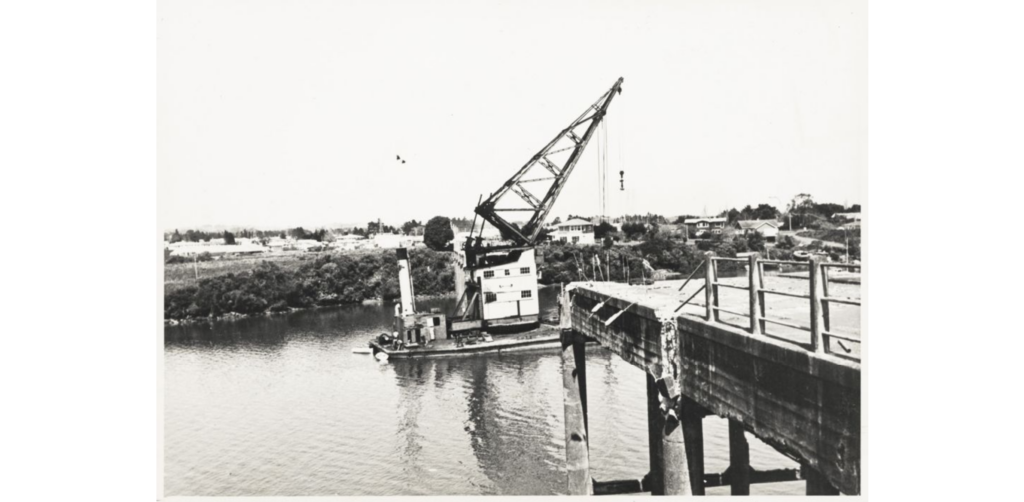
A much higher bridge deck allowed boats and small ships to pass through underneath. However, before long major safety concerns were raised and planning began for yet another Panmure bridge. The second bridge was eventually demolished in 1963 with the help of a barge-mounted crane. Remnants of the concrete entry gates are still visible on either side of the river.
Third Tamaki / Panmure Bridge, 1959-present
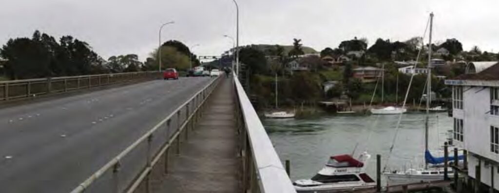
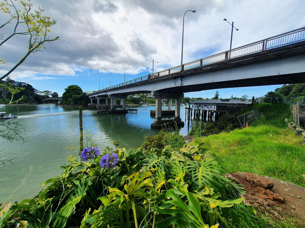
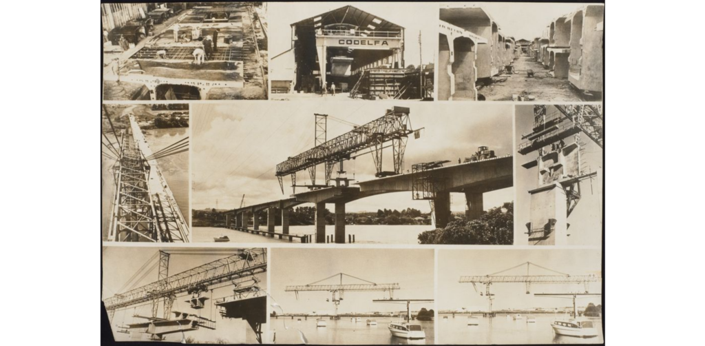
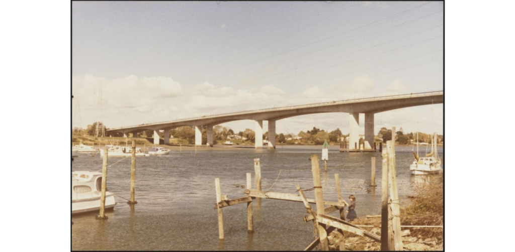
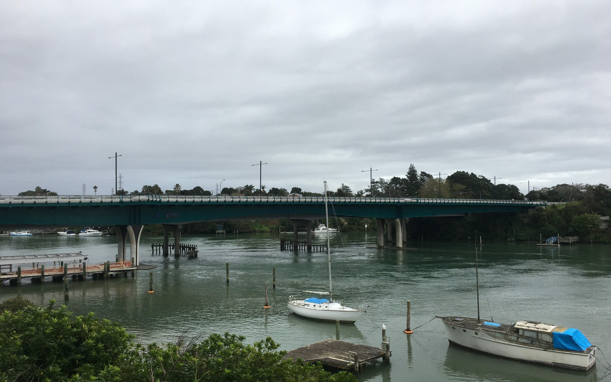
To replace the structurally-compromised second bridge, a third bridge was built close to the former course of the first bridge on the eastern bank. Lagoon Drive was built to serve this bridge. It was designed by AO Barrowclough of Andrew Murray Partners for the Manukau County Council. Construction of this Panmure bridge also included an important water main pipe underneath the road surface. The bridge was opened to the public on 19 December 1959.
Originally a two-lane bridge, the third Panmure bridge was widened to three lanes in 1972. It is still in use today and features a tidal flow system: the centre lane is used for westwards traffic flow in the morning and eastwards in the afternoon. It is scheduled to be replaced around 2040.
Bridge 4: Pakuranga-Waipuna Motorway Bridge, 1974-present
In order to connect East Auckland to the Auckland Southern Motorway, a fourth Tamaki River crossing was constructed in the 1970’s. This bridge was designed by Gavin Cormack (Beca Carter Hollings and Ferner), built by Etude et Enterprises and formally opened on 10 May 1974.
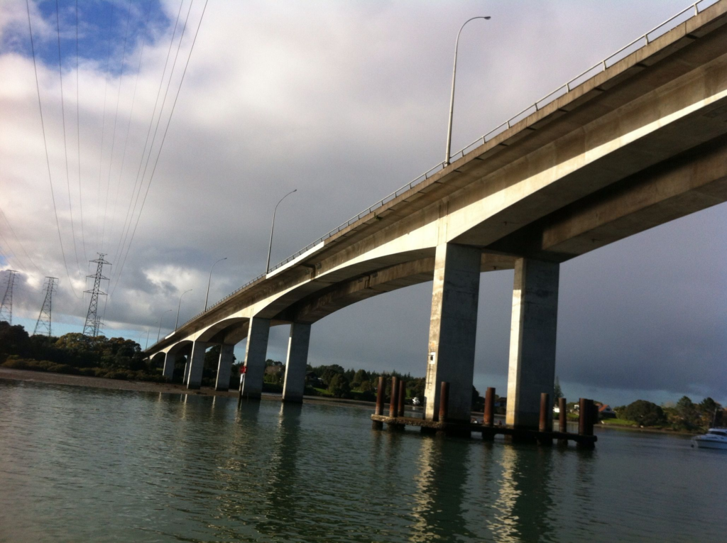
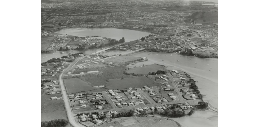
The Waipuna motorway bridge is located further south of the previous bridges. It rises from the eastern side over Millen Avenue and connects with Waipuna Road on the western bank of the Tamaki River and onwards to the motorway as the Southeastern Arterial Road. It’s still the main way (and frequently congested) way to drive from East Auckland to the city, though the addition of the long-awaited Reeves Road flyover will change things significantly.
Bridge 5: Eastern Busway Bridge, 2021-present
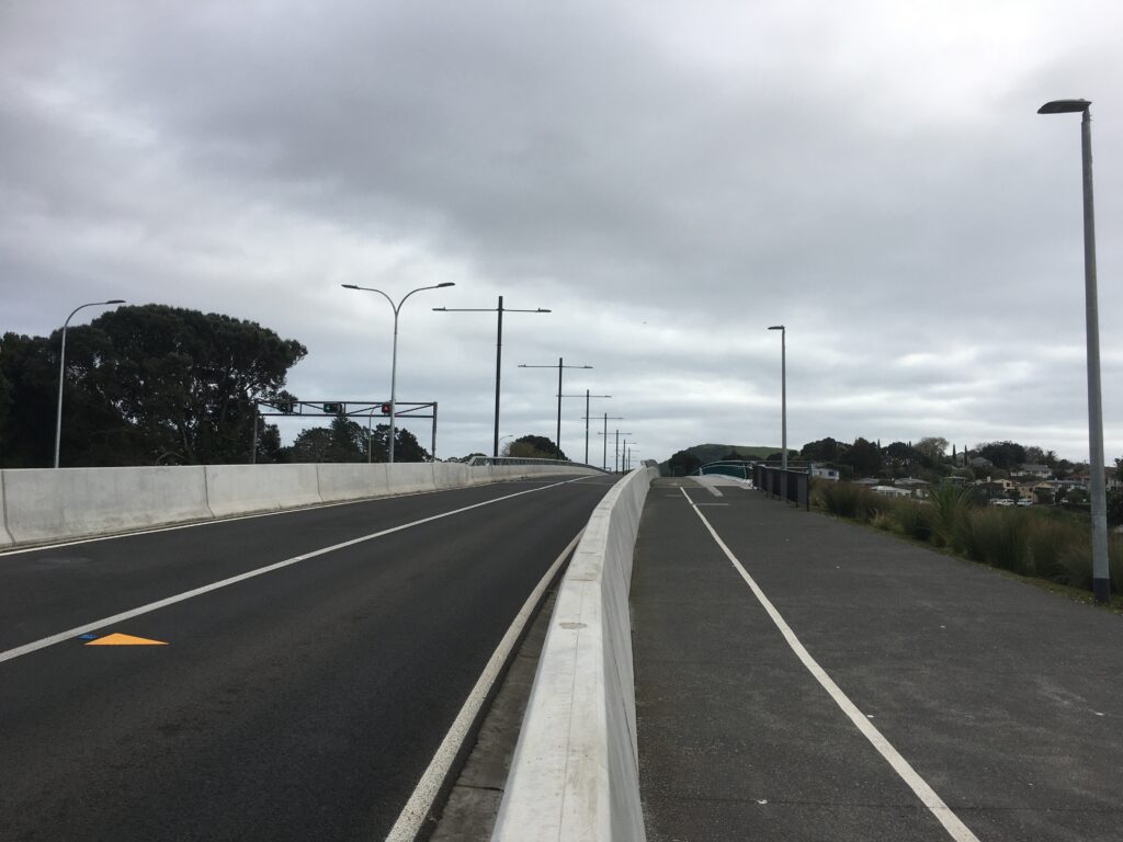
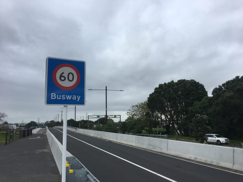
As part of the AMETI / Eastern Busway project, a fifth bridge for buses and active transport was designed and completed in 2021. The 205 metre-long bridge comprises two bus lanes, a cycleway and a footpath and forms a key part of connecting the city centre to Botany. Once the entire busway route is complete, Auckland Transport have promised that travel by bus and train between Botany and Britomart will take 40 minutes, even in rush hour.
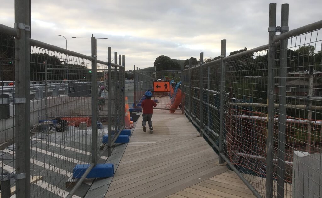
As construction of the Eastern Busway Bridge occurred during the COVID pandemic, our family enjoyed frequent walks and bike rides over to watch its progress up close as part of our lockdown routine (at the time, there wasn’t much else we could visit!). Some highlights were watching specialist divers build the bridge’s pile caps from the water, seeing the huge green bridge structure gradually cantilevered into position over the river using hydraulic jacks and rollers, and trying out the different detours the construction staff put in as different parts of the bridge and approach were completed.
The bridge was finally opened to walkers and cyclists on September 2021 (a welcome relief during Auckland’s Delta lockdown) and officially opened for buses on 15 December 2021.
Each “Panmure bridge” served its purpose at a different era of our city’s history. Considering that the first swing bridge was opened in 1865, there’s over 150 years of history underneath our feet or wheels each time we cross the Tamaki river.
It’s hard to imagine what the sixth or seventh Tamaki River crossings will look like, perhaps in 50 years’ time. It’s also sparked me to think more and more about how to build bridges between different cultures, and ways followers of Jesus are called to be bridge-builders within the church and with our neighbours. After all, at the heart of the Christian faith is a Saviour who bridges the gulf between God holiness and humanity’s sin. Yet whether it’s 1865 or 2023, we’ll always need a way to get from A to B.


